微縮地形旅遊指南
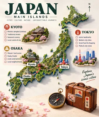
以核對後的輪廓為依據,製作帶目的地和路線的微縮旅行地圖。
上傳已驗證的地圖,並提供已核對的目的地與路線說明。
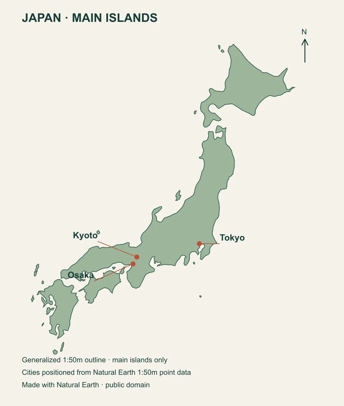
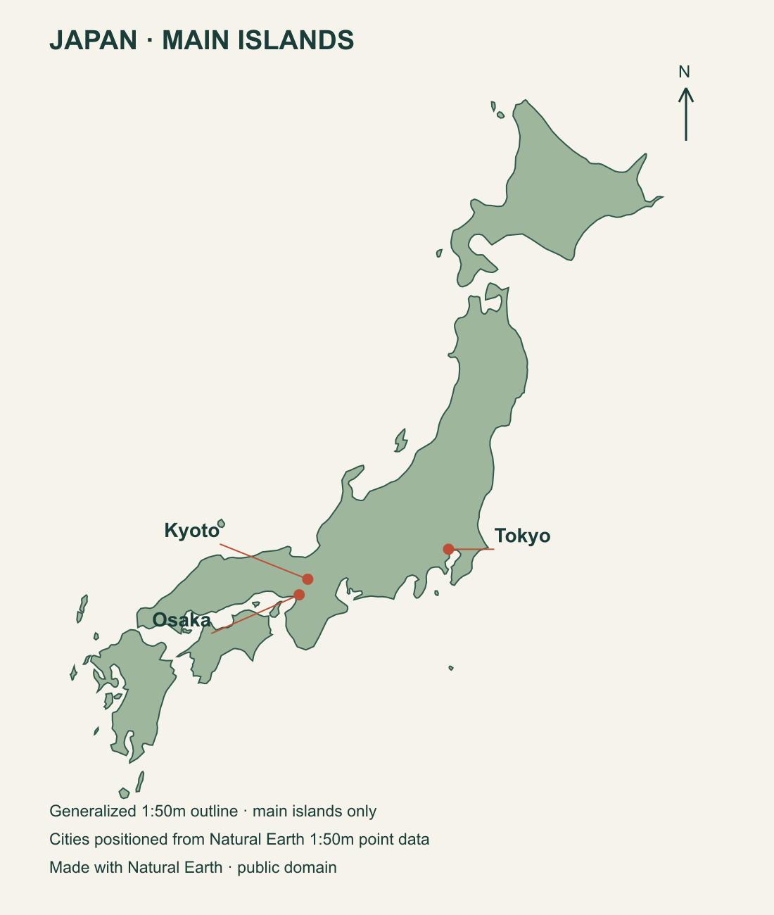
參考圖
使用方法
上傳已驗證的地圖,並提供已核對的目的地與路線說明。
這是示意路線圖;請對照參考地圖檢查標籤位置。
實測結果
本例由內建圖像工具生成,工具未回傳精確的模型 ID。執行記錄保留實際提交的提示詞與依序排列的輸入圖片。
參考地圖
提供的引導圖採用公有領域資料集 Natural Earth 的主要島嶼輪廓與城市點位。這是概略插圖,省略了較小的離島。
地圖範圍
這是主要島嶼的示意插圖,搭配裝飾性地形起伏與地標。生成地圖並非導航地圖;發布前,請對照提供的參考圖片檢查標籤位置。
已核對的目的地名稱
城市景點已與 GO TOKYO 及 Kyoto Travel 交叉核對。裝飾性微縮地標並非地圖座標。
測試樣張
0147-A · 變體
- 模型
- GPT Image 2.5
- 記錄日期
- 2026年10月29日
- 服務供應商
- OpenAI
- 範本 v1
- 微縮地形旅行指南
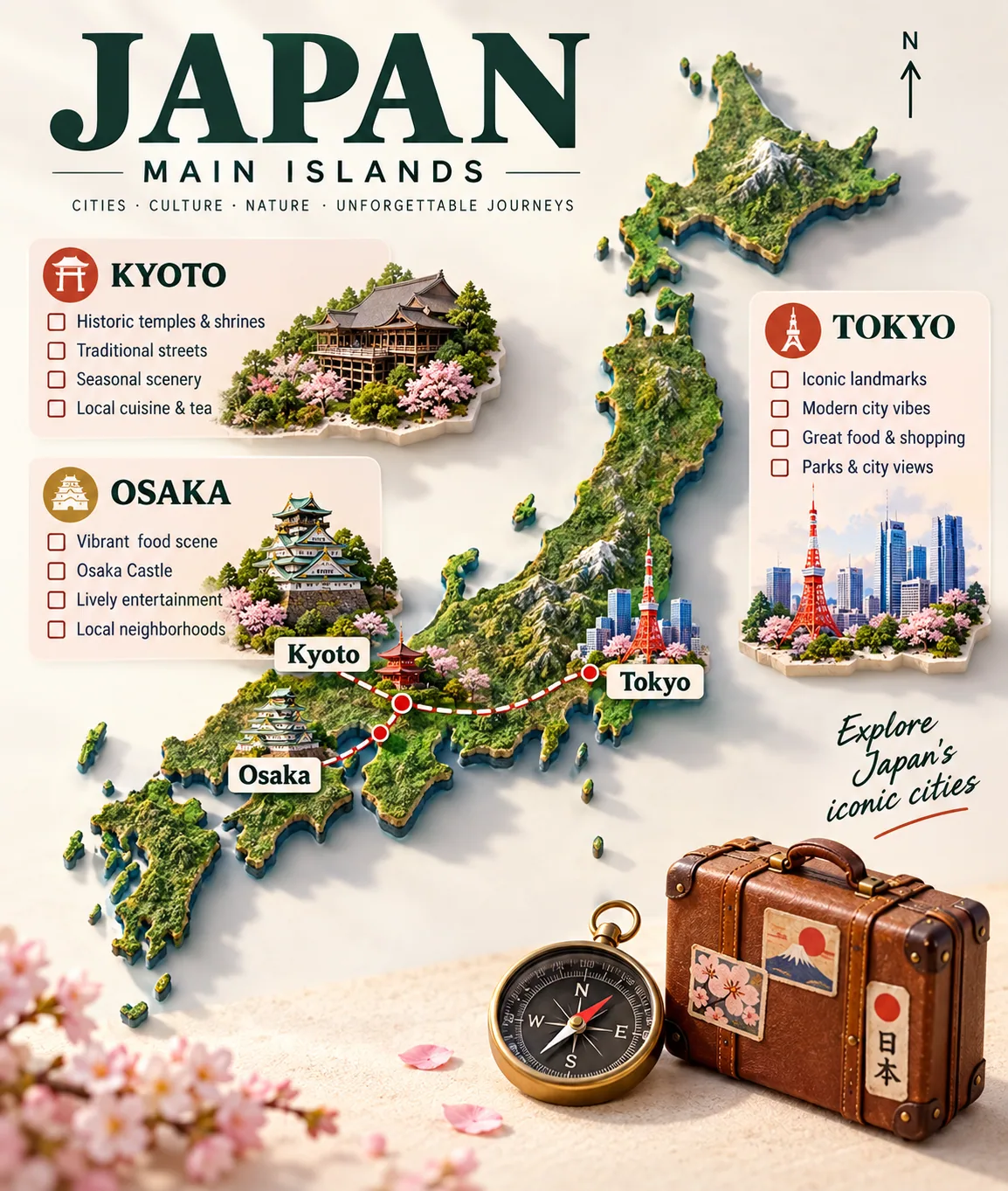
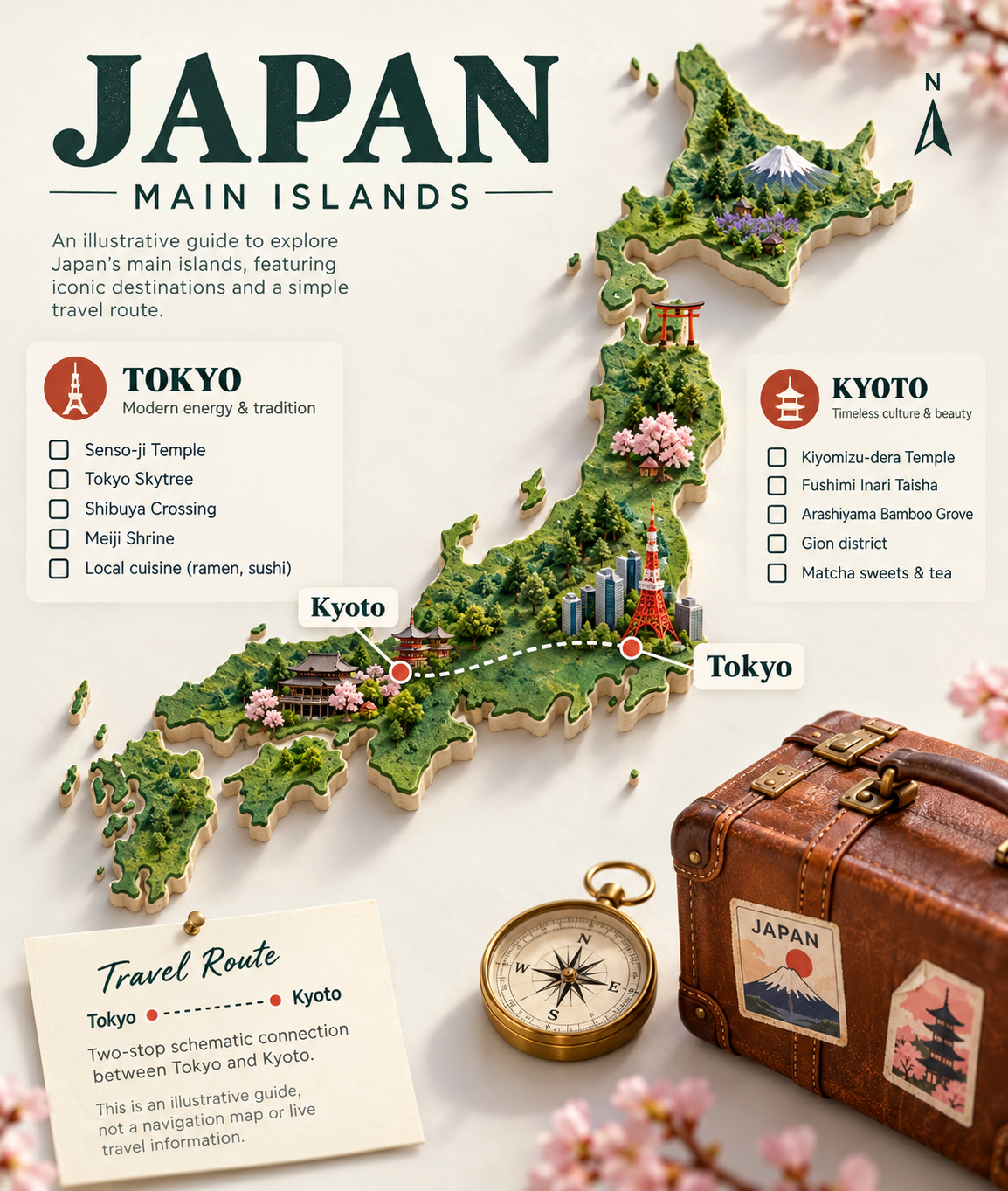
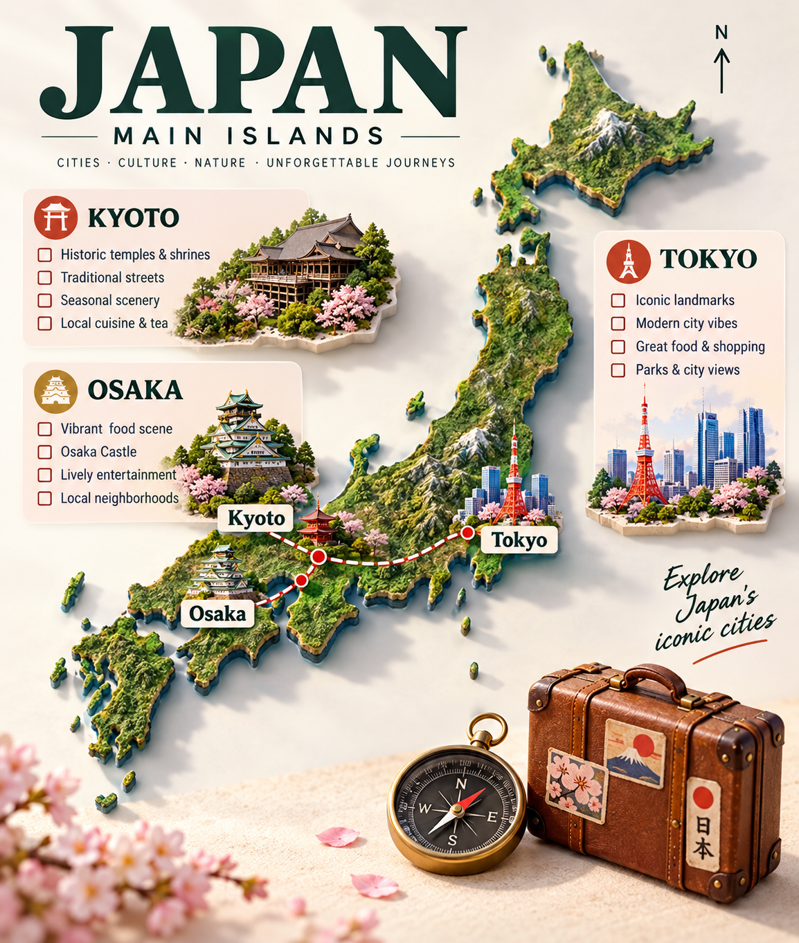
觀察: Tokyo 與 Kyoto 以不帶方向的虛線相連。主要島嶼,以及明確的示意/不可導航聲明均可讀。地標與地形起伏屬裝飾,不是地理空間測量。
這張樣張使用的提示詞
Build a travel infographic for Japan using the supplied verified map. Destinations: Tokyo; Kyoto. Route notes: Two-stop schematic connection between Tokyo and Kyoto. Connect their checked positions with one neutral dotted line without any arrowheads or directional symbols. Exclude Osaka from the destination list. Label the map MAIN ISLANDS; this is an illustrative guide, not a navigation map or live travel information.. Render the map as a raised miniature terrain model with a few recognizable landmark miniatures. Add clear city labels, route lines and concise checklists in the margins. Place a small suitcase and compass beside the map. Use a light studio background and readable typography.
0147-B · 展示執行
- 模型
- GPT Image 2.5
- 記錄日期
- 2026年10月29日
- 服務供應商
- OpenAI
- 範本 v1
- 微縮地形旅行指南
觀察: 主要島嶼與城市順序可辨認;路線屬示意,不能用於導航。已核對預設標籤 Tokyo、Kyoto、Osaka。另一版本因路線箭頭方向與 Tokyo 到 Kyoto 的說明相矛盾而未採用。
來源與授權
- 提示詞
- 作者:Prompt Seen授權:CC BY 4.0
- 核對後的地圖
- 創作者:Natural Earth; layout by Prompt SeenPublic-domain map data; generalized main islands with city markers授權:Public domain圖像來源由程式生成
- 以核對後的輪廓為依據,製作帶目的地和路線的微縮旅行地圖。
- 創作者:Prompt SeenPrompt Seen · AI-generated demonstration授權:CC BY 4.0AI 生成的圖片
- 以核對後的輪廓為依據,製作帶目的地和路線的微縮旅行地圖。
- 創作者:Prompt SeenPrompt Seen · AI-generated demonstration授權:CC BY 4.0AI 生成的圖片
靈感來源與證據
本站提示詞為獨立改寫,展示圖片為本站記錄的生成結果。
- 原始內容
- X · TechieBySA2026-04-11T19:23:56.000Z
- 來源互動快照
- 整篇貼文或圖集按讚: 3,902 · 回覆: 67觀察時間:2026-10-29T06:10:42Z
- 證據
- 官方公開 API 快照未取得完整原始提示詞;本次為獨立改編。
這些數字屬於原始貼文或影片,是調研時的快照,並非即時計數或本站圖片的評分。